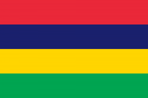
Country Profile
The Republic of Mauritius is situated in the south west Indian Ocean, approximately 2,400 km from the south east coast of Africa, located just to the north of the Tropic of Capricorn. The island is only 67 km in length and 46 km at its widest point, with a total land area of 2,040 km², owing its origins to submarine volcanic activity. Although the volcanoes are long since dormant, they have left their mark on the profile and landscape of the island. As a political entity, the Republic includes not only the island of Mauritius but also the tiny island of Rodrigues some 563 km to the east, as well as the Cargados Carajos Archipelago (St. Brandon) and the two virtually uninhabited Agalega islands, 400 km to the north east and 1,000 km to the north of Mauritius respectively.

Head of State: H.E Prithvirajsing Roopun
Capital City: Port Louis
Independence Day: 12 March 1968
Languages: English, French and Creole
GDP: USD 14.22 Billion
Currency: Rupee
Area/Size of country (km²): 2,040 km²
Natural resources: Natural resources: Sugar care, Tea, Forests, Fish, Minerals, Arable Land
Time Zone: (GMT+4)
Ministry Responsible for COMESA Affairs
Hon. Dhananjay RAMFUL
Minister of Foreign Affairs, Regional Integration and International Trade
11th Floor, Newton Tower
Sir William Newton Street,
Port Louis – Mauritius
Email: secretariatmofa@govmu.org
National COMESA Focal Point
Mrs M. Dabee Hauzaree
Director of Cooperation – Regional Integration
Ministry of Foreign Affairs, Regional Integration and International Trade
9th Floor, Newton Tower
Sir William Newton Street,
Port Louis – Mauritius
Email: mdabee-hauzee@govmu.org
Permanent Representative to COMESA
Mr. S.D. Khundoo
Principal Analyst (Cooperation)
Ministry of Foreign Affairs, Regional Integration and International Trade
9th Floor, Newton Tower
Sir William Newton Street,
Port Louis – Mauritius
Tel: + 230 405 2629
Fax: + 230 2137672
Email: khundoo@govmu.org
This post is also available in:


